No more ignoring it and ducking in your car on your way to work. Pilots are in it from start to finish.
There are several excellent resources available to the pilot (and mere mortals as well) to assist in the decision-making process and exercise good ADM.
Understand the difference between “Observations” and “Forecasts”. Observations are typically organized from ancient history to the very recent, and forecasts are science fiction.
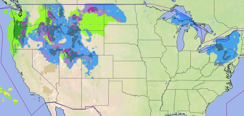
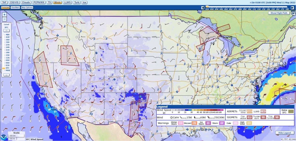
The most complete, accurate and FREE tool geared toward aviators is the GFA (Graphical Forecasts for Aviation). This tool, managed by NOAA, is excellent for local and cross-country flight planning purposes. Use it for checking winds, weather fronts, visibility, cloud levels, icing layers, SIGMETS, etc. along with your super-imposed flight path to see up to 18 hours into the future with, not perfect, but surprisingly good accuracy.
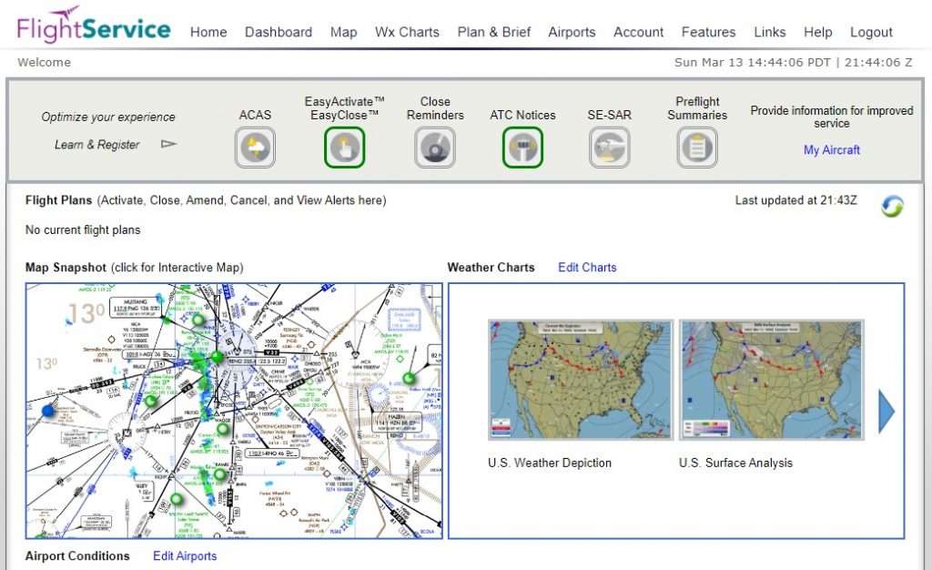
Couple the GFA with the flight planning capabilities available, again for FREE, from 1800WXBRIEF (just create a free account) and it makes flight planning, filing, opening and closing flight plans easy.
For local area forecasts going out three and ten days there are another couple of sites I’ve found very useful and use daily.
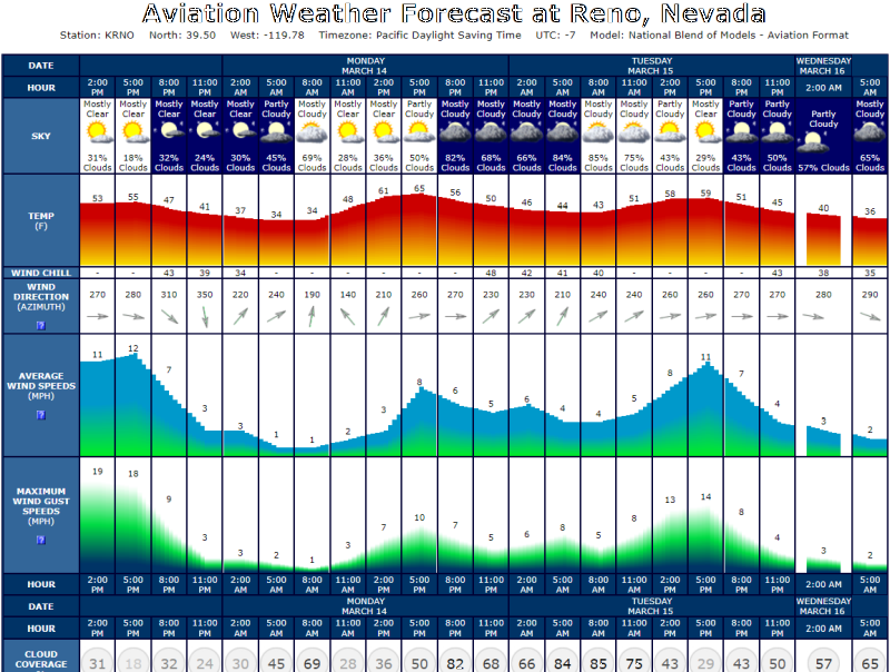
For a good three-day outlook I use and recommend USAIRNET.COM which has a page titled “Aviation Weather Report and Forecast“. From there you can enter the ICAO code for the nearest large airport and a select number of smaller ones. A comprehensive three-day forecast is shown which, again, isn’t perfect, but does provide a very good expectation of what the local area flight conditions will probably be like.
For a long-term outlook I have found that Weather Underground has an informative report that can provide a good expectation of a local area forecast and assist in longer-term flight planning.
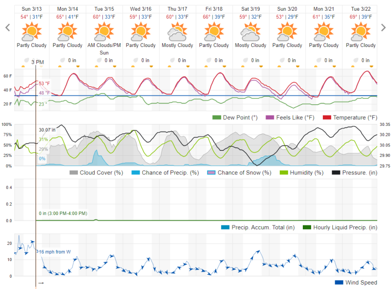
From the main Weather Underground page you can select a nearby weather station and after that select the “10-DAY” tab. Simply bookmark that tab and check it every day to see what’s in store for your area. The ability to do all this without an account and also FREE makes it an obvious choice.
There are a few other popular weather sites to use such as Windy.com (nice visuals with a forecasting tool) and the “Numerical Forecast Models” provided by the College of DuPage (more technical and sophisticated short, medium and long rage forecast modelling).
When it comes to paid solutions Garmin Pilot is making improvements, however the top of the list continues to be ForeFlight. The weather and flight planning tools available on that platform are considerable and are the reason why that company continues to lead the general aviation industry. ForeFlight is not ‘cheap’, but it is also not prohibitively expensive and their more professional options are locked away in a higher subscription tier, so for the average VFR pilot the basic subscription can provide a lot of utility. However, unless there is a real need for their offerings, the free services outlined above will work well for most people.
When it comes to Apps for Android smartphones I’ve found a few tools that help:
My number one ‘go-to’ app is Avia Weather for Android. I can quickly look at all the METARs and TAFs from my area airports and read through them to get a lot of information on what the area weather forecasts are shaping up to be.

Another is the ATIS App (FREE! – Ads at the bottom) for Android. It does exactly what its name implies, it downloads the D-ATIS from airports that provide that service (not all towered airports do). This makes getting the ATIS you need for ATC easier than listening to the robot voice on the radio frequency drone on for four minutes to get through all the details. Just ensure that it is the current ATIS by checking the time.

For night flying and ensuring accurate logging of night flight hours and landing currency, I’ve found the LunaSolCal app very handy and easy to use. Since this app accurately calculates Civil Twilight in sync with the Air Almanac times it complies with § 1.1 definition of “Night” so you can confidently log your night flight time, night landings and night landings for carrying of passengers (those two landings are not the same – read the rules carefully).

Just remember the old pilot adage; “Better to be on the ground, wishing you were flying than to be flying, wishing you were on the ground.”